


- Start Date
- 2026/07/22
- End Date
- 2026/07/24
- Event Name
-
International Engineering Expo 2026
- Event Details
-
Period: 22-24 July 2026
Venue: Hall 55-56 | Queen Sirikit National Convention Center (QSNCC)
Booth No. D07: TOPCON POSITIONING THAI
Time: 10:00 am - 6:00 pm
- URL
- External URL
- Target
- _blank
GNSS Receiver Case Study
GSX2
GNSS Has Outsized Impact on Miyakojima Civil Engineering Project!
GNSS Receiver GSX2 Dramatically Streamlines Farmland Irrigation Work
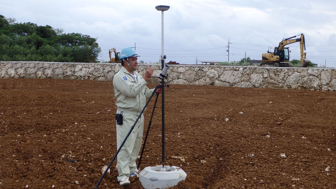
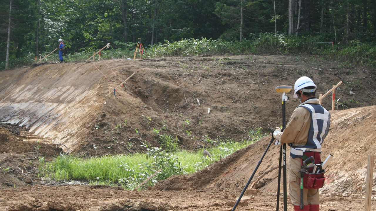
The island of Miyakojima sits in the southern seas of Japan, surrounded by some of the most beautiful coral reefs in the world. Local construction company Sonan Kaiji Ltd. ushered in a sea change by introducing GNSS to civil engineering works, and graced us with an interview.
Improving Efficiency of Island Civil Engineering Works
“Our main business is harbor construction, but we also take on general civil engineering work, which includes a lot of construction of farmland irrigation facilities,” Sonan Kaiji Construction Department Director Takeharu Sonan said.
The main industry of Miyakojima is agriculture, namely sugarcane farming. Because the island was formed through the sedimentation of coral reefs, there are no large mountains or rivers; securing fresh water for irrigation is a major concern. This concern creates healthy demand for construction of irrigation facilities, chief among them the world’s first underground dam. “Farmland irrigation projects support the island,” Sonan said. “There is a lot of work to do, and depending on the season, not much time to do it.
For surveying present states and completed work to date, we have used, as you may imagine, total station technology, which requires two to three workers. We wanted to do our surveying more efficiently, and that is when we learned about the GSX2 and the GNSS-enabled SDR8 Civil Master, an application for data collectors.”
Impressive Impact on Efficiency and Clients
Sonan Kaiji immediately noticed the effects of using the GSX2, which is a GNSS receiver designed for civil engineering surveying. “The speed of our work has increased dramatically now that we need only one person to do surveying,” Sonan said. “Our surveying is now two to three times as efficient as before, in terms of both cost and time. And the results with GNSS do not depend on how experienced the operator is, which is not the case with total stations. Anyone can do surveying work quickly and produce accurate, consistent results. I was the only operator at first, but the equipment was so easy to use that now nearly all our employees use it. Also, the ability to output sectional SIMA has decreased the time required for plotting work by one-third. All things considered, efficiency has improved more than we could have expected.”
Of course, the technology yields results in areas other than irrigation facility construction. In the outputting of positional information for the rough cutting of a road, Sonan praised the technology for making the surveying “stress-free, like a walk in the park.”
Sonan also related that clients have expressed surprise at the shorter construction schedules, and that competitors have asked for help with their own surveying work. The director also mentioned that the introduction of the new technology boosted his company’s evaluation scores.
Next Challenge: A Hybrid Survey System
By now, most construction companies on the island view GNSS equipment as integral to surveying work, and use it regularly. The early-adopting Sonan continues to experiment with the technology by doing things such as adding its own RTK pole tips. “We currently combine the use of GNSS and total stations depending on the location and required precision, but I wonder if there isn’t a way to use both at once in a sort of hybrid survey system,” Sonan mused. “We could aim for even greater efficiency if we could easily switch back and forth between the equipment. That’s probably our next target.”
Sonan Kaiji’s deep interest in this hybrid survey system and tireless pursuit of efficiency should continue to improve its future as well as that of Miyakojima.
Interviewees
COMPANY: Sonan Kaiji Ltd.
SOKKIA PRODUCT: GNSS Receiver GSX2
Related Item
News
Events
- Start Date
- 2024/12/20
- End Date
- 2024/12/20
- Event Details
-
Dates: December 20, 2024, (Friday)
Time: 10:00 a.m. - 12:00 p.m.
Venue: Sinnsathorn Tower Building, 11th Floor (Conference room)
Map: https://maps.app.goo.gl/Lu6YypSv9nmQznJv8
Registration [ Free] : https://www.surveymonkey.com/r/TOPCON_ESN
Organizer: Topcon Positioning Asia (Thailand) Co., Ltd.
- URL
- /content/topcon-pa/th/en/events/2024/08112024.html
- External URL
- Target
- _self
- Start Date
- 2024/10/16
- End Date
- 2024/10/18
- Event Details
-
Dates: 16-18 October 2024
Time: 09:00 am. - 5:00 pm.
Venue: BITEC Bagna, Hall EH101
Organizer: DIDACTA
- URL
- https://didacta-asia.com/
- External URL
- Target
- _blank