


- Start Date
- 2026/07/22
- End Date
- 2026/07/24
- Event Name
-
International Engineering Expo 2026
- Event Details
-
Period: 22-24 July 2026
Venue: Hall 55-56 | Queen Sirikit National Convention Center (QSNCC)
Booth No. D07: TOPCON POSITIONING THAI
Time: 10:00 am - 6:00 pm
- URL
- External URL
- Target
- _blank
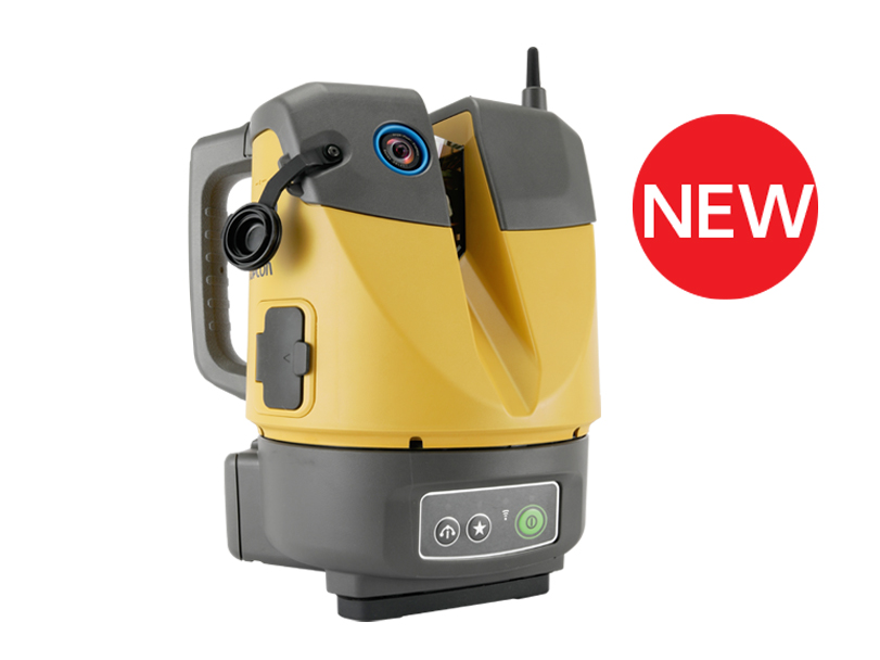
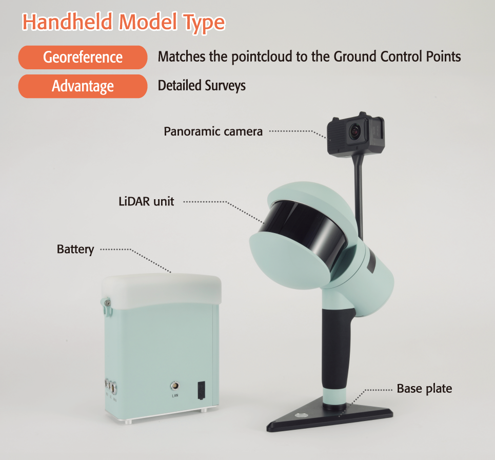
D-H100
Mobile Scanner
Handy and quick scanning solution for any project!
ーAnywhere, Easy, Just walkingー
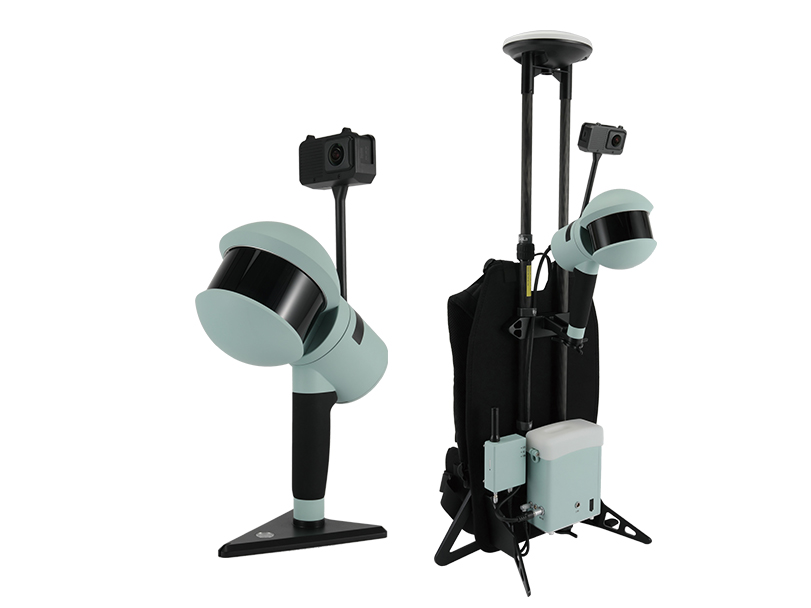
The D-H100 is a handheld mobile scanner that uses LiDAR SLAM technology allowing you to scan even in the most challenging environments.
*SLAM Technology: A modern technique that uses LiDAR Technology & Imagery Sensors that has been broadly adopted in surveying for fast and accurate mapping of complex environments.
An evolution in 3D measurement!
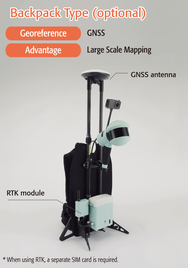
D-H100 comes with flexible line-up options that can be changed to suit your needs. Either used as a handheld scanner for detailed measurements or as a backpack scanner with GNSS for large scale mapping of wide and or complex areas in a short period of time. The fastest and easiest data acquisition in areas where terrestrial laser scanners and UAVs struggle!
Quick & Smart 3D Data Capture with SLAM Technology
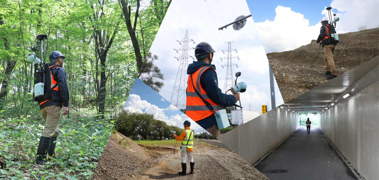
Obtain detailed 3D data simply by walking through the site—even in narrow, complex, or hard-to-reach areas. With D-H100, you can quickly cover disaster sites, buildings, and structures where using traditional surveying is challenging.
Choose the scanner model that fits your workflow: a handheld model for flexible mobility or a backpack model for large-area coverage. Both deliver accurate measurements across a wide range of applications.
The captured 3D data helps you to visualize your sites, making the D-H100 an essential tool for construction planning, documentation, and design.
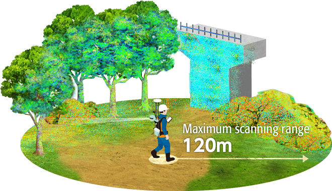
Use Case: This scanner can ascertain any and all current conditions in 3D.
Surveying
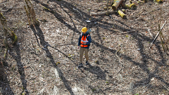
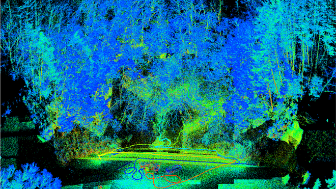
D-H100 can acquire data on current conditions in a variety of environments like:
Forest, rivers, embankments, cities, parks, underground, tunnels, natural disaster sites, mines, and more.
Civil Engineering
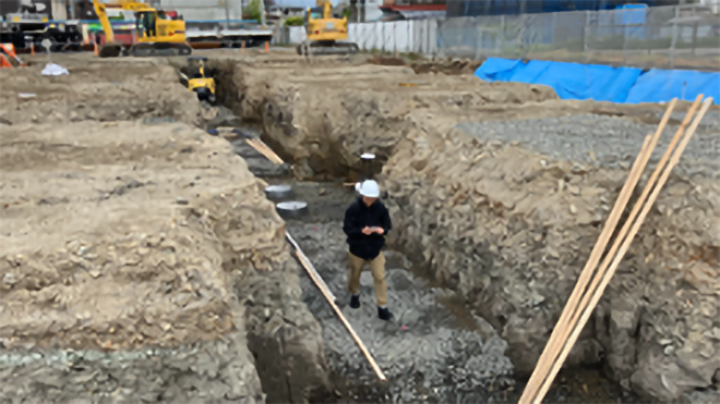
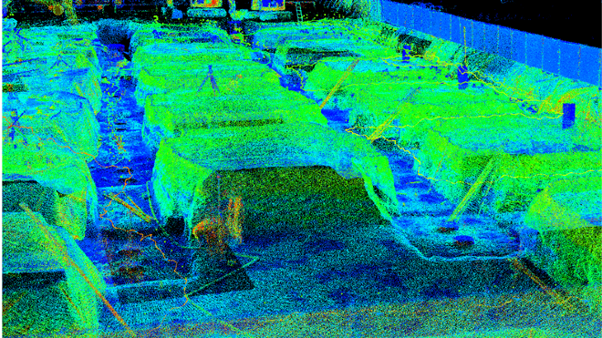
Get a full understanding of your construction site with D-H100 in 3D.
It offers a wide array of uses including site reconnaissance, initial surveys, progress management, temporary construction/construction planning, calculating volumes and more.
Building Construction


D-H100 can be used both indoors and outdoors, so it can be utilized for BIM, facilities, plants, 3D modeling, digital twins, and more.
Feature
* Coming soon
Compact LiDAR
- 16-line scanner
- Maximum scanning range: 120m
- 320,000 points per second
Panoramic camera
- 5.7K resolution and 30-fps video enables accurate and precise color rendering
SLAM system
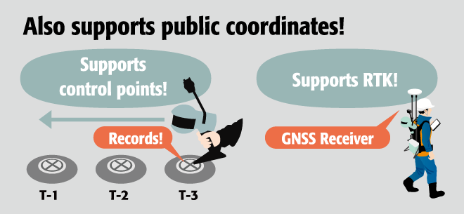
- A practical piece of kit, with combinations of not just SLAM-only, but also RTK-SLAM, PPK-SLAM, and GCP
Selectable measurement formats
- Handheld model type
- Backpack type
Real-time display
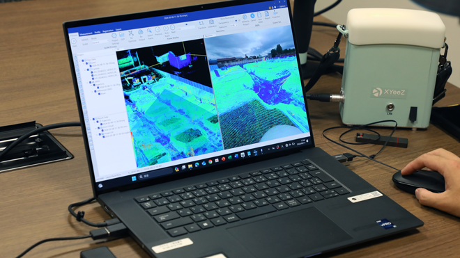
- The Field Software allows visualizing the pointclouid data during data collection.
SLAM analysis
- Automated analysis using SLAM analysis software
Dedicated software
Dedicated field software
Display pointcloud in real-time. Supports your data collection with its intuitive operation.
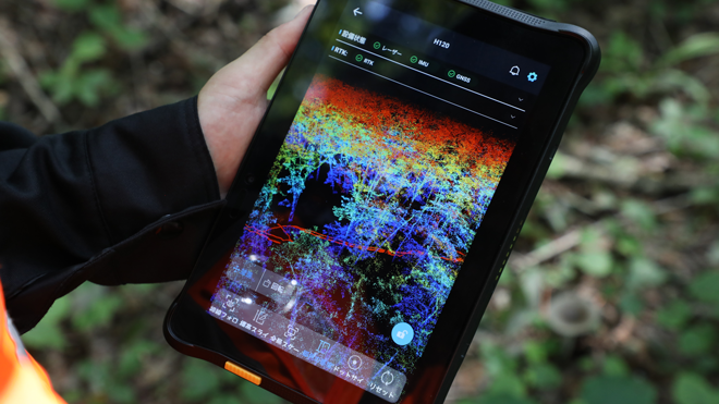
Main configuration and data acquisition can all be done via a tablet.
・Project management
・Measurement configuration
・RTK configuration
・Record GCPs (ground control points)
・Check status
・Check gathered data
・Output data
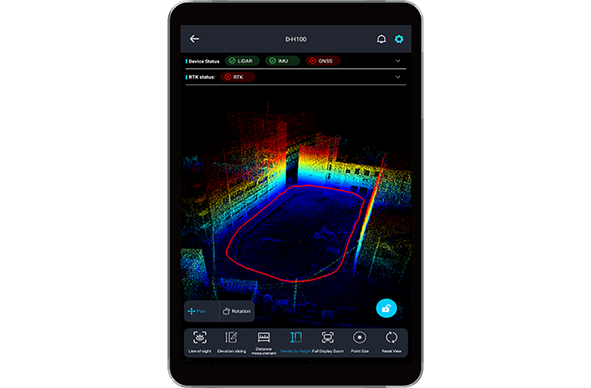
Dedicated analysis software
Transform your walked path into a georeferenced trajectory using SLAM Analysis.
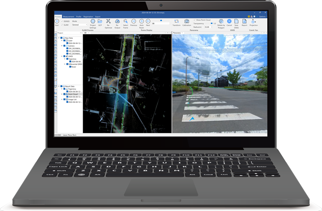
・Automated SLAM analysis
・RTK/PPK processing
・Adjust GCPs (ground control points)
・Color-code point groups (RGB)
・Dimension measurements
・Cross-section measurements
・Output data (LAS)
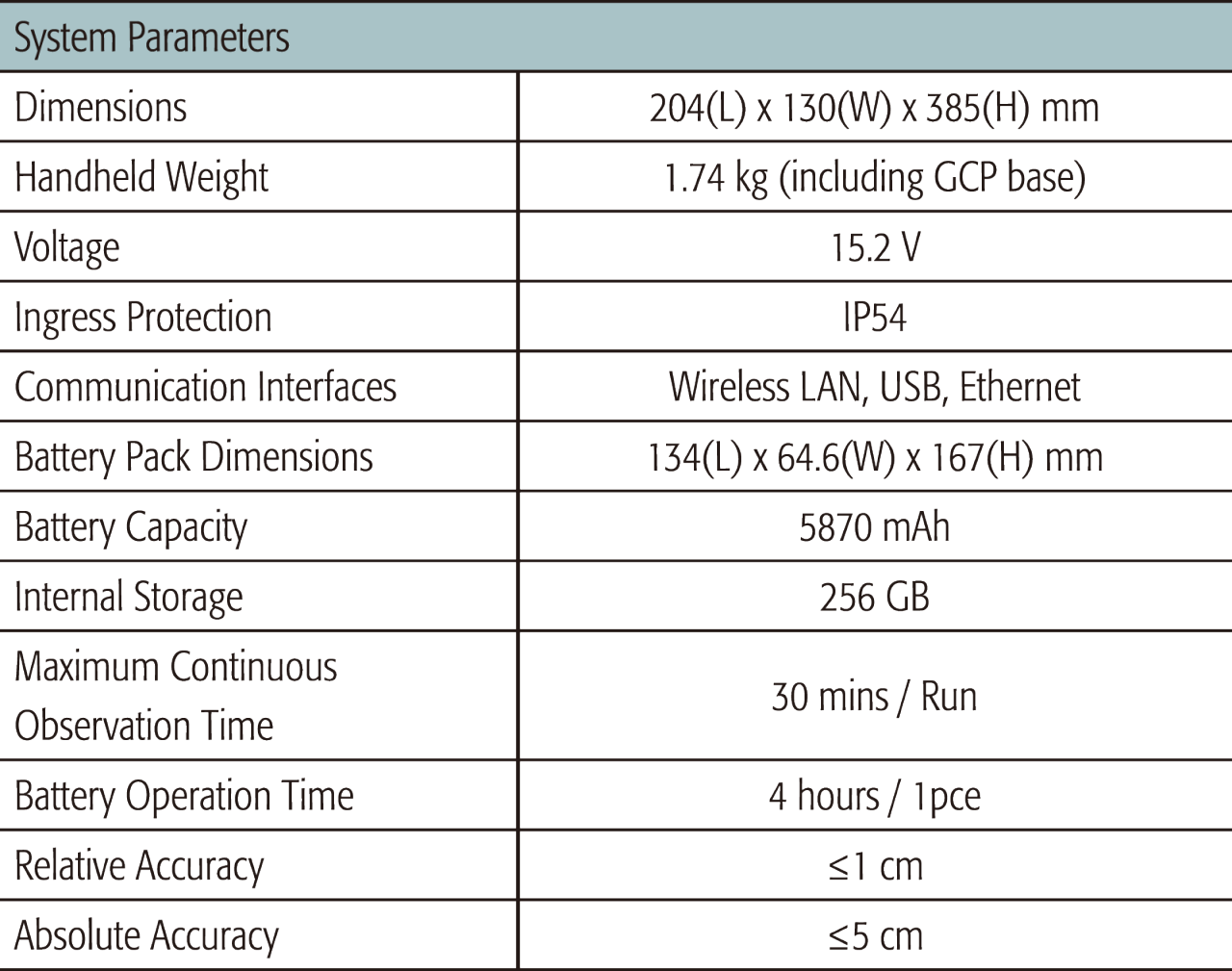
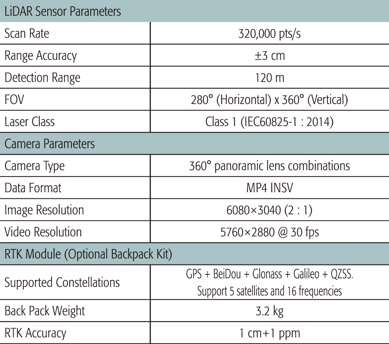
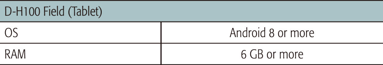
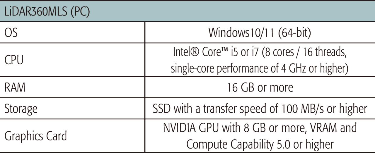
SPECIFICATIONS
System Requirements
Brochure
Video
Mobile Scanner D-H100
Related Use Cases
Related Information
News
Events
- Start Date
- 2024/12/20
- End Date
- 2024/12/20
- Event Details
-
Dates: December 20, 2024, (Friday)
Time: 10:00 a.m. - 12:00 p.m.
Venue: Sinnsathorn Tower Building, 11th Floor (Conference room)
Map: https://maps.app.goo.gl/Lu6YypSv9nmQznJv8
Registration [ Free] : https://www.surveymonkey.com/r/TOPCON_ESN
Organizer: Topcon Positioning Asia (Thailand) Co., Ltd.
- URL
- /content/topcon-pa/th/en/events/2024/08112024.html
- External URL
- Target
- _self
- Start Date
- 2024/10/16
- End Date
- 2024/10/18
- Event Details
-
Dates: 16-18 October 2024
Time: 09:00 am. - 5:00 pm.
Venue: BITEC Bagna, Hall EH101
Organizer: DIDACTA
- URL
- https://didacta-asia.com/
- External URL
- Target
- _blank