- Start Date
- 2025/12/19
- End Date
- 2025/12/19
- Event Details
-
วันศุกร์ที่ 19 ธันวาคม พ.ศ.2568
สถานที่: ห้องประชุมชั้น 11 อาคารสินสาทรทาวเวอร์ (ใกล้BTSสถานีกรุงธนบุรี ทางออก1)
เวลา: 08:30-13:30น.
ผู้จัดงาน: บริษัท ท็อปคอนโพซิชั่นนิ่งเอเชีย (ไทยแลนด์) จำกัด
บริษัท CST Instrument (Thailand) จำกัด
- URL
- /content/topcon-pa/th/th/events/2025/25122025
- Target
- _self
LS-B20 / B20W
Laser Sensor
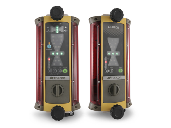
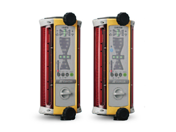
Two types of Laser Sensor for different applications
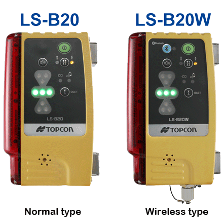
Two types are available: The LS-B20W wireless type, and the LS-B20 normal type.
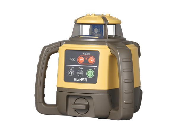
In combination with a Rotating Laser, they can be used in all kinds of fields, including everything from residential land development, land readjustment, cultivated land maintenance, sewerage works, and land reclamation to interior finishing.
Easy and simple installation
The LS-B20/B20W can be easily set up on heavy machinery or for use by individuals. Even novice operators, regardless of their skill level or experience, can use the device with confidence.
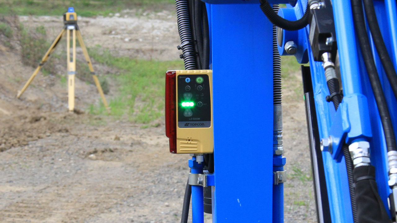
Usage example with an excavator
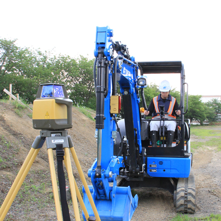
The magnetic mount for heavy machinery attaches and detaches easily, allowing for simple and strong setup on heavy machinery arms. It can be used for controlling grade, such as for the height of excavation surfaces, for slopes, and for floor excavations for sewerage works. In addition, the beam display uses both LED and sounds on the panel to indicate level positioning.
Usage example with an individual
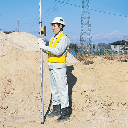
The "HOLDER-6 (Optional)" allows the device to be installed by individuals. Individual use enables the device to be used for interior work in addition to civil engineering and construction.
Compact and lightweight body
The lightweight body weighs just 500 g.* The device can be kept in the pockets of work clothes thanks to its compact design.
*Excluding batteries.
Excellent environmental resistance
Environmental performance with an IP66 JIS protection rating. This device can be used safely in the harshest of conditions.
Easy-to-use features when on site
Laser Manager remote display (optional)
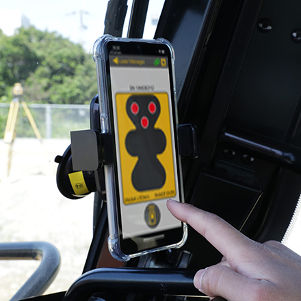
Using Laser Manager, you can show the same display as LS-B20W on your smartphone in real time, allowing the operator to check it from inside the cabin while working. Settings such as on-grade matching can be performed then and there, without having to exit the driver's seat to operate the device itself.

On-grade matching
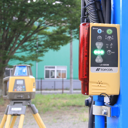
Even if the Laser reference height and the sensor on-grade position become misaligned, there is no need to adjust the Laser Sensor mounting height. The on-grade matching function enables you to set a height offset at the touch of a button.
Significantly reduced construction time
Land leveling work can be done quickly and with excellent finishing precision, significantly reducing construction time.
Work that used to be done by three people can now be done by a single person.

Can be used for various applications
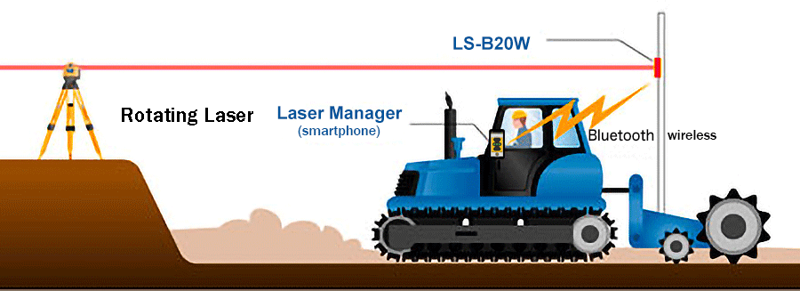
Usage example with a tractor (using LS-B20W/Laser Manager)
The LS-B20W mounted on a pole above the rear leveler detects height differences.
With the exact same display shown on a front-mounted smartphone with Laser Manager installed, you can instantly tell if the leveler is too high or too low.
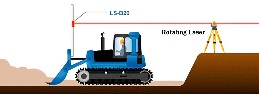
Usage example with a bulldozer (using LS-B20)
The LS-B20 mounted to a pole above the excavator blade detects height differences.
With this, you can instantly tell if the excavator blade is too high or too low.
Related Item
News
What's New
Events
- Start Date
- 2024/12/20
- End Date
- 2024/12/20
- Event Details
-
Dates: December 20, 2024, (Friday)
Time: 10:00 a.m. - 12:00 p.m.
Venue: Sinnsathorn Tower Building, 11th Floor (Conference room)
Map: https://maps.app.goo.gl/Lu6YypSv9nmQznJv8
Registration [ Free] : https://www.surveymonkey.com/r/TOPCON_ESN
Organizer: Topcon Positioning Asia (Thailand) Co., Ltd.
- URL
- /content/topcon-pa/th/en/events/2024/08112024.html
- Target
- _self
- Start Date
- 2024/10/16
- End Date
- 2024/10/18
- Event Details
-
Dates: 16-18 October 2024
Time: 09:00 am. - 5:00 pm.
Venue: BITEC Bagna, Hall EH101
Organizer: DIDACTA
- URL
- https://didacta-asia.com/
- Target
- _blank


