


- Start Date
- 2024/12/20
- End Date
- 2024/12/20
- Event Details
-
Dates: December 20, 2024, (Friday)
Time: 10:00 a.m. - 12:00 p.m.
Venue: Sinnsathorn Tower Building, 11th Floor (Conference room)
Map: https://maps.app.goo.gl/Lu6YypSv9nmQznJv8
Registration [ Free] : https://www.surveymonkey.com/r/TOPCON_ESN
Organizer: Topcon Positioning Asia (Thailand) Co., Ltd.
- URL
- /content/topcon-pa/th/en/events/2024/08112024.html
- Target
- _self
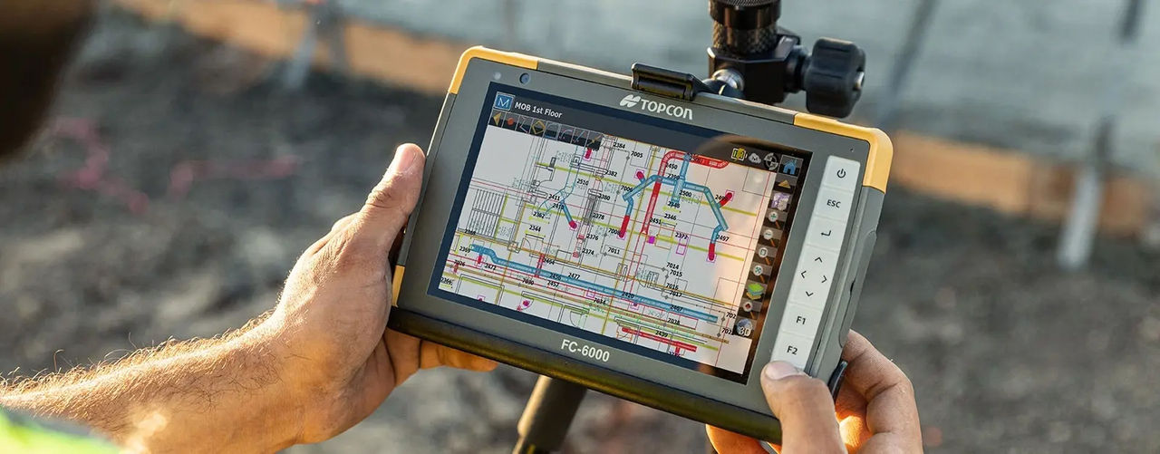
MAGNET Field
Data Collection Software
Boost efficiency and accuracy onsite with MAGNET Field
Powerful layout, surveying, and construction workflows in the palm of your hand
- Easy to use and learn
- 3D layout
- Data handling
- Professional field-based, quality reporting
- Map-based workflows
- Hybrid GNSS and total stations control
Harness the power of MAGNET Field

MAGNET Field streamlines surveying and construction workflows by providing accurate measurements, data collection, and real-time collaboration.
It integrates seamlessly with other Topcon products and is compatible with more than 50 industry-standard formats, making it a valuable tool for professionals in various sectors. For example, surveyors and construction professionals use MAGNET Field to accurately measure and map land, buildings, and other structures.
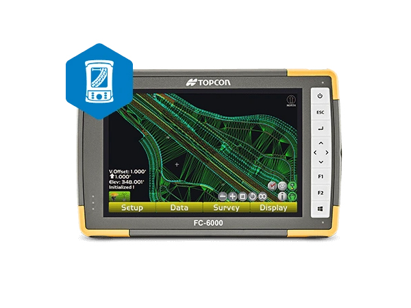
Measure, map, and mark points

MAGNET Field controls your GNSS rover to collect points and measurements, lay out or stake job sites, and verify as-built conditions. This data is then available for digital terrain models, contour and surface comparison calculations, and to determine cut and fill volumes.
Control instruments with tablets and Android devices

MAGNET Field turns your rugged tablet or compatible Android device into a field controller for Topcon GPS receivers, robotic total stations, scanning robotic total stations, and digital levels.
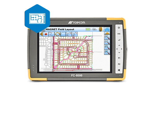
Use cases

- Land surveying, stakeout, and cadastral projects
- Construction layout
- Roadwork
- Utility mapping
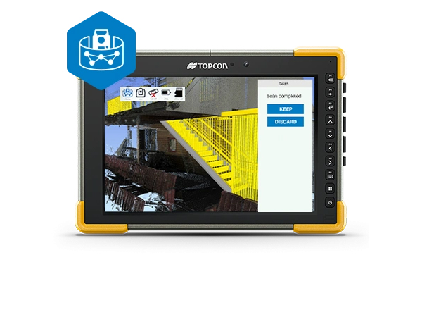
Share data between equipment and users in the field or office

MAGNET Enterprise allows secure project information sharing, including geo-referenced data maps, redline models, and visual stakeout progress. Quickly collaborate with team members to share or convert file types compatible with MAGNET Office, Sitelink3D, Autodesk, and Bentley.
Enterprise is included with MAGNET software subscriptions.
Get the right tablet for your needs

MAGNET Field turns your tablet into a data collector, field controller, and field productivity device. Choose the right tablet for your operating system preferences, working style, and application.
Brochure
Video
The ultimate solution for more efficient workdays
Related Item
Related Information
News
Events
- Start Date
- 2024/10/16
- End Date
- 2024/10/18
- Event Details
-
Dates: 16-18 October 2024
Time: 09:00 am. - 5:00 pm.
Venue: BITEC Bagna, Hall EH101
Organizer: DIDACTA
- URL
- https://didacta-asia.com/
- Target
- _blank
- Start Date
- 2024/01/01
- End Date
- 2024/01/31
- Event Name
-
Utilization of scanner theodolite For surveying and 3D modeling (Seminars & Demonstrations)
- Event Details
-
Utilization of scanner theodolite For surveying and 3D modeling (Seminars & Demonstrations)
Date: January 19 (FRI.)
Venue: Access Tak Province, Rajamangala University of Technology Lanna Tak, Conference Room at Civil and Environmental Engineering
Organizer: Topcon Positioning Asia (Thailand) Co., Ltd.
- URL
- /content/topcon-pa/th/en/events/2023/24012024.html
- Target
- _self