


- Start Date
- 2024/12/20
- End Date
- 2024/12/20
- Event Details
-
Dates: December 20, 2024, (Friday)
Time: 10:00 a.m. - 12:00 p.m.
Venue: Sinnsathorn Tower Building, 11th Floor (Conference room)
Map: https://maps.app.goo.gl/Lu6YypSv9nmQznJv8
Registration [ Free] : https://www.surveymonkey.com/r/TOPCON_ESN
Organizer: Topcon Positioning Asia (Thailand) Co., Ltd.
- URL
- /content/topcon-pa/th/en/events/2024/08112024.html
- Target
- _self
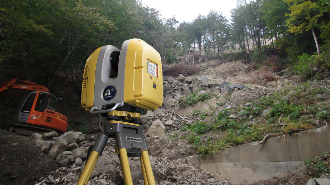
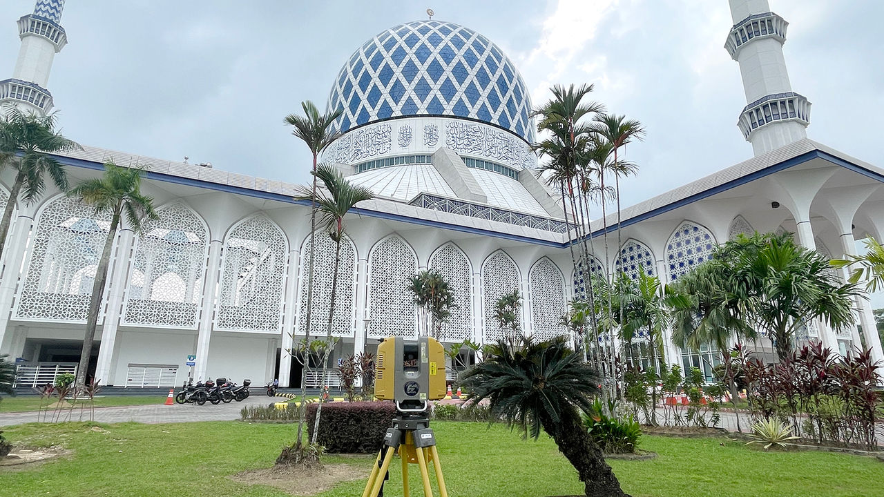
3D Laser Scanner Case Study
GLS-2000
Convinced by 3D laser scanner built by known surveying instruments manufacturer
The GLS-2000 can measure even complex terrain very quickly with its high mobility and maneuverability!
Izumi Sokuryou Ltd. is a surveying company in Shibukawa, Gunma, which actively incorporates new technologies, such as GIS systems and 3D laser scanners in their projects. Recently, they began using the GLS-2000.
Better mobility was needed
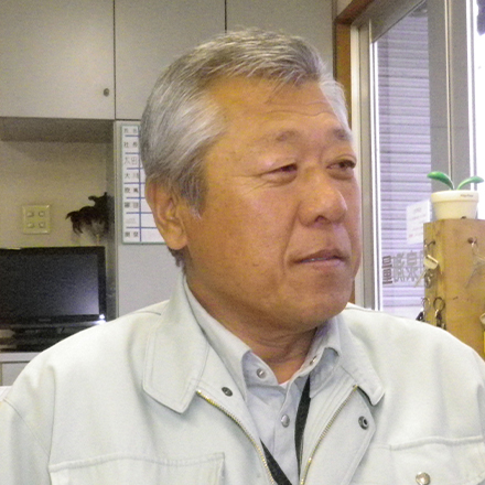
“We started using a long range 3D Laser Scanner in 2005, and accumulated our experience and know-how on many surveying projects,” said Haruo Okuizumi, managing director of the company.
“The scanner we had been using was capable of long-range measurements. However, since it is a large instrument and needs many targets and a PC, we recognized its efficiency limitations due to its mobility. Actually, we could move the instrument over different station points only up to seven points-per-day with three operators. Therefore, we were looking for an instrument that could achieve better efficiency and found the GLS-2000,” he said.
Efficiency of measuring greatly improved
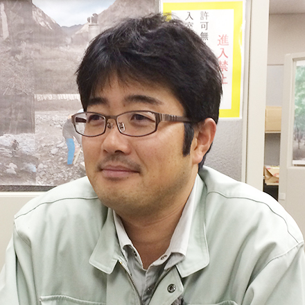
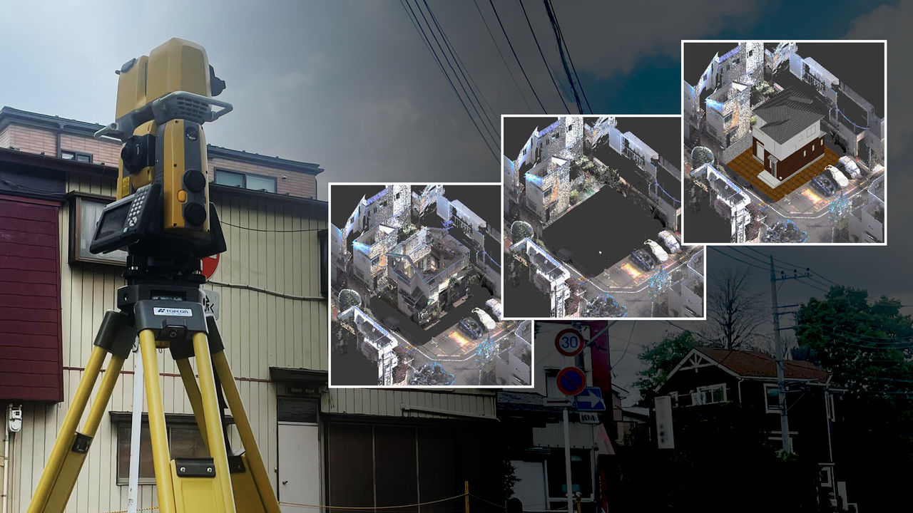
Takashi Ota, head of the information systems division, explained how efficiency was improved with the GLS-2000. “The first measuring work for which we applied the GLS-2000 was at the landslide site, to measure the terrain just after the disaster and after construction rebuilding and to calculate volume of the moved soils.
The site was not a large area, at 50 m wide and 150 m long, however its very complex shapes necessitated to measure from many station points. We had to measure from 10 station points at the site, but surprisingly we accomplished it in less than one day. With the former scanner, this job would have taken one and a half to two days with three people,” he said. The GLS-2000 with high mobility based on compact design and standalone-measuring capability enabled the efficiency improvement.
Another important point is that the GLS-2000 includes an orientation method with a known station point and back sight observation. With former scanner, we needed to perform a tie point method as the registration when we need to achieve a good measuring accuracy, which required many targets and a lot of experience to determine location of those target points.
“With the GLS-2000, the method with a known station point with back sight observation requires only one target at the back sight point, and is very familiar to surveying engineers in our company.
Other operations, in general, are also simple enough that our engineer, who has experience using total station, could easily master handling the GLS-2000.
We were impressed with the GLS-2000, which is bit different from other scanners and carefully designed, as a product developed by an established surveying manufacturer,” he said.
Utilizing the scanners depends on the site situation
Mr. Okuizumi explained how they choose to utilize their scanners. “There are often sudden orders for scanning measurement which require prompt actions. Therefore, we use our scanners in a flexible arrangement, by applying the GLS-2000 for a complex terrain site, and another scanner for widely extended site. Also, we would extend applying the scanner, for newer applications of monitoring structures, such as stone walls and dams,” he said.
He noted that his company will continue to extend and accelerate the use of GLS-2000 in their jobs going forward.
Interviewees
COMPANY: Izumi Sokuryou Ltd.
TOPCON PRODUCT: 3D Laser Scanner GLS-2000
Related Item
News
Events
- Start Date
- 2024/10/16
- End Date
- 2024/10/18
- Event Details
-
Dates: 16-18 October 2024
Time: 09:00 am. - 5:00 pm.
Venue: BITEC Bagna, Hall EH101
Organizer: DIDACTA
- URL
- https://didacta-asia.com/
- Target
- _blank
- Start Date
- 2024/01/01
- End Date
- 2024/01/31
- Event Name
-
Utilization of scanner theodolite For surveying and 3D modeling (Seminars & Demonstrations)
- Event Details
-
Utilization of scanner theodolite For surveying and 3D modeling (Seminars & Demonstrations)
Date: January 19 (FRI.)
Venue: Access Tak Province, Rajamangala University of Technology Lanna Tak, Conference Room at Civil and Environmental Engineering
Organizer: Topcon Positioning Asia (Thailand) Co., Ltd.
- URL
- /content/topcon-pa/th/en/events/2023/24012024.html
- Target
- _self