


- Start Date
- 2025/11/05
- End Date
- 2025/11/07
- Event Name
-
SMART CONSTRUCTION·SAFETY·AI EXPO 2025
- Event Details
-
Date : November 5 (Wed) – November 7 (Fri), 2025
Venue : KINTEX Exhibition Center 2, Halls 7 & 8
Organizer: Ministry of Land, Infrastructure and Transport
- URL
- https://smartconexpo.com/
- External URL
- Target
- _blank
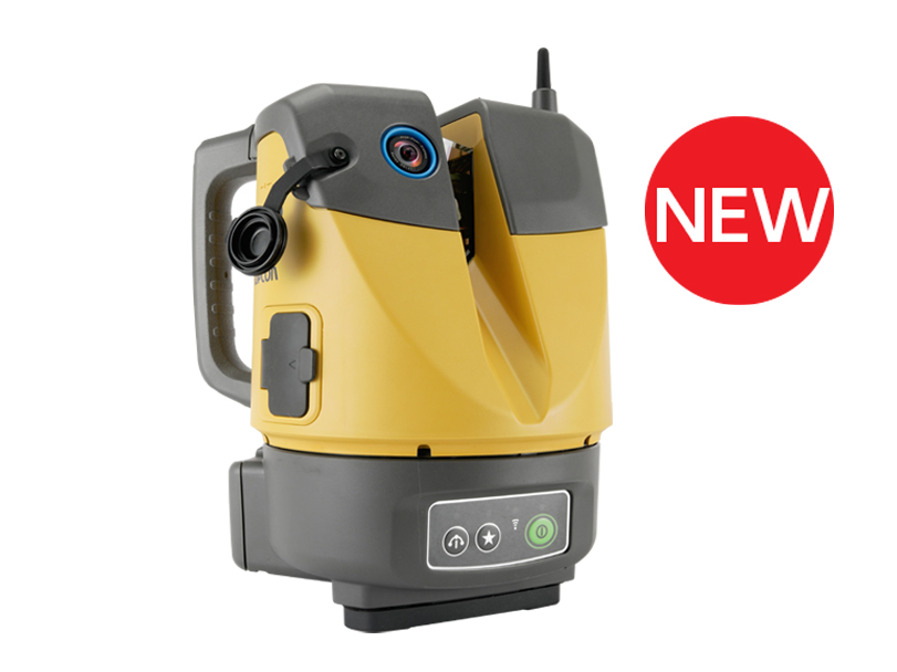
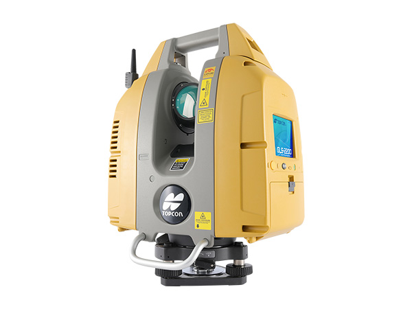
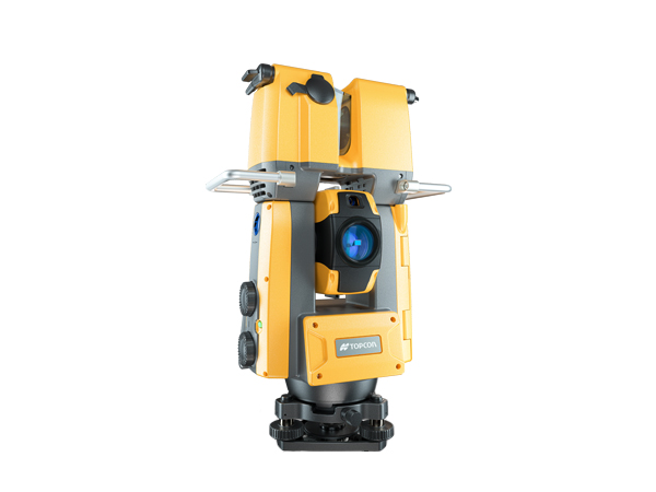
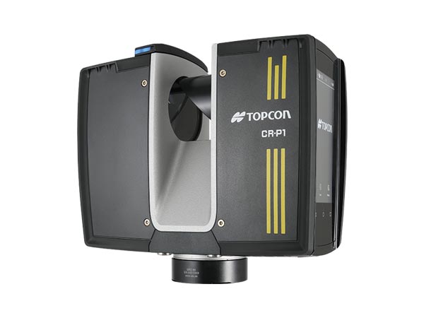
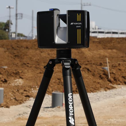
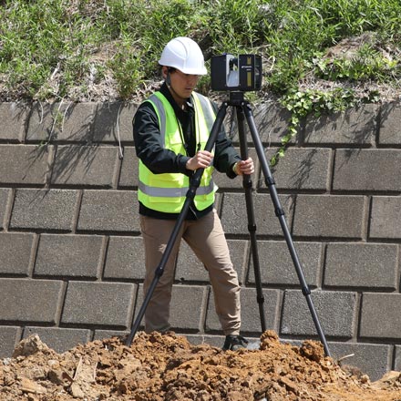
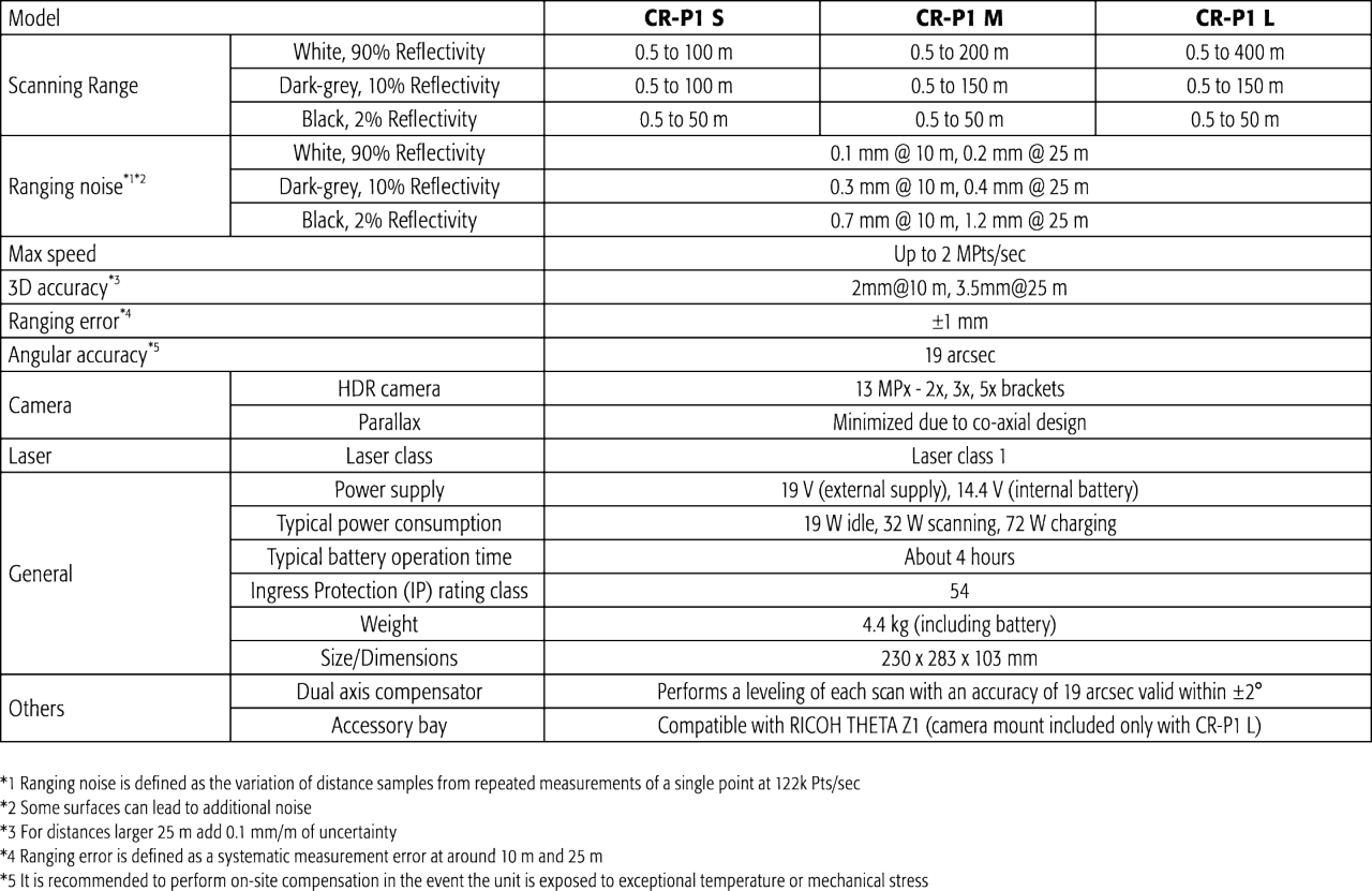
CR-P1 series
3D Laser Scanner
New top-of-the-line model with improved point density and speed
Up to 2 million points per second. Scanning speed approximately 16 times faster than conventional models.
- High speed, high density, high accuracy
- Up to 400 m scanning range
- High performance in a lightweight 4.4 kg body
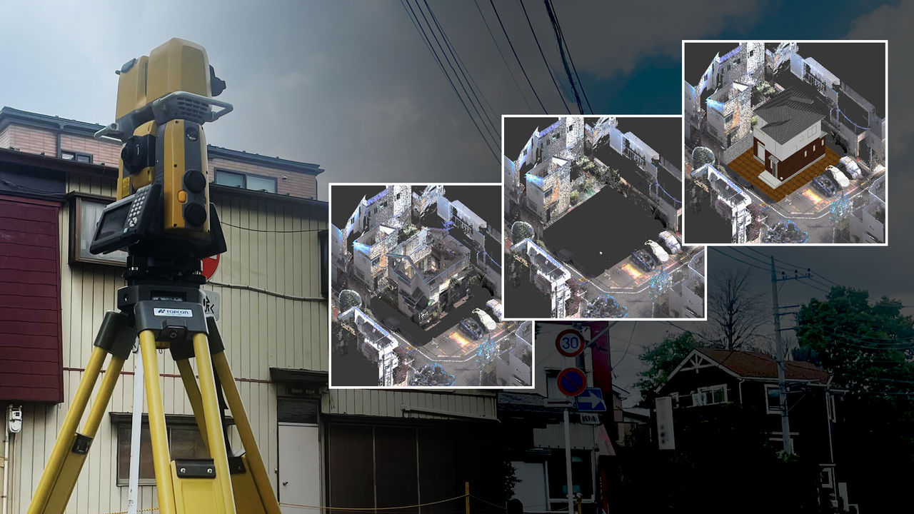
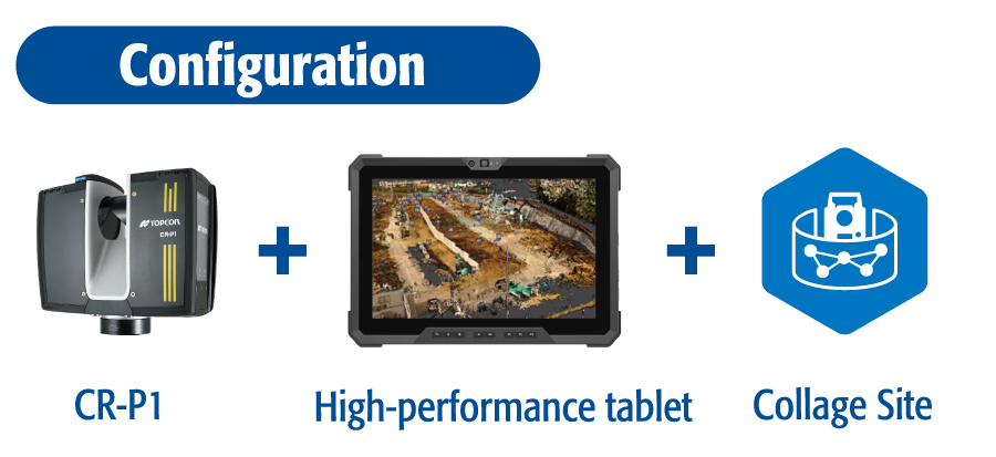
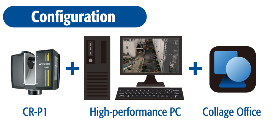
- Two different processing Software:
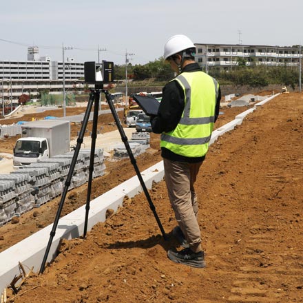
On-Field Registration: Collage Site
Office Solution: Collage Office - Choose between different camera sensors
- Real-Time scanning status indicators
One scanner for multiple job sites with high-level specifications!
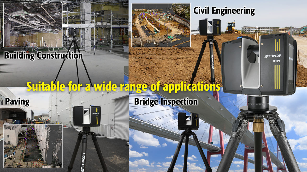
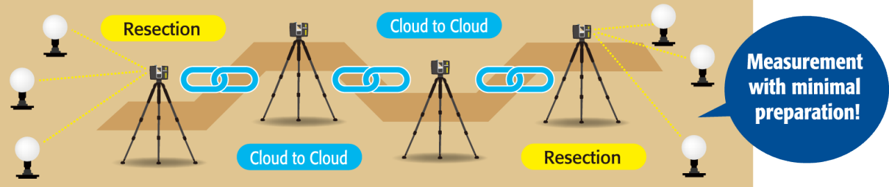
It supports both cloud to cloud and resection, making it easy to use in different areas
High speed, high density, high accuracy
This top-of-the-line model offers high speed and high density while maintaining the long range and high accuracy of conventional models. With up to 2 million points per second, the scanner offers a scan speed approximately 16 times that of conventional models.
Up to 400 m scanning
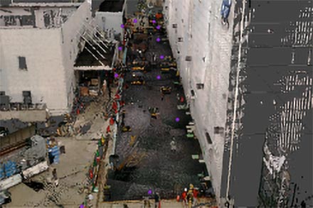
Wide-area measurements can be performed in one scan with scanning range of up to 400 m.
It can also reliably scan high-altitude targets such as tall buildings and high-voltage power lines.
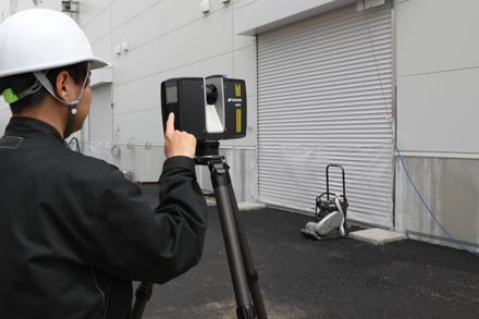
High performance in a lightweight 4.4 kg body
Despite its high performance, the compact and lightweight body (4.4 kg) and the quick-release mechanism that allows easy attachment and
detachment from the tripod provide excellent mobility. Even in environments where frequent repositioning is required, shifting the scanner is quick and easy.
Choose from two different processing software Collage Site/Collage Office
Collage Site allows you to complete work fully on-site, while Collage Office enables a wide variety of analysis in the office, including high-density clouds. Choose any of these two processing styles to suit your work.
Choose between camera sensors
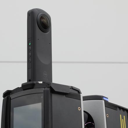
Choose from a built-in camera for colorizing the pointcloud or an external panoramic camera for speed.
The measurement time for an external camera is just 2 seconds!
Real-Time scanning status indicators
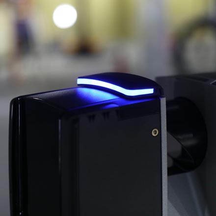
The system provides real-time status feedback during scanning and image capture through visual and auditory indicators. This allows operators to monitor device activity even during remote operation, ensuring reliable and confident measurement workflows.
Choose between two processing styles
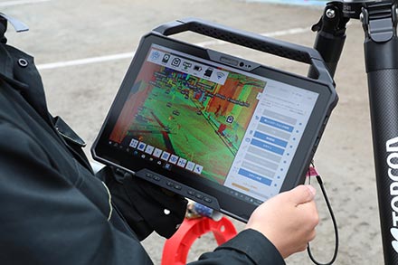
On-Site Package


Field scanning control and processing software Collage Site + CR-P1
Cloud generation and flatness can also be checked while on site
"Collage Site" enables a fully on-site workflow—from remote operation of the CR-P1 and 3D point cloud acquisition to data analysis and export—all completed directly in the field. By combining point cloud matching with resection methods, it delivers both high accuracy and operational efficiency. Additionally, with new functionality that visualizes flatness based on elevation differences, users can achieve more precise measurements and reduce rework, supporting faster and more reliable field operations.
Combination of resection and cloud to cloud
Fast and detailed analysis


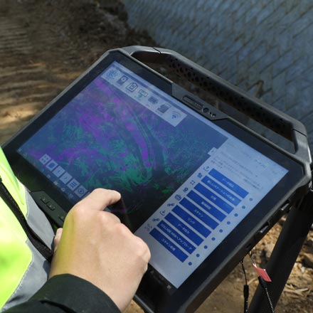
3D Point Cloud Processing Software Collage Office + CR-P1
Easy post-processing of high-density, data
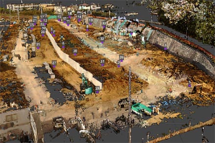
With the high-speed, high-density capabilities of the CR-P1, even fine surface details can be captured with precision. Ultra-dense pointcloud will increase processing load, however Collage Office enables fast analysis. This applies to even in high demanding environments like ICT pavement construction where full utilization of dense point clouds is essential. This workflow allows scanning to be completed quickly on-site, with detailed analysis handled in post-processing. Additionally, by leveraging Collage Office’s core feature—merging point cloud data from multiple sensors—you can generate highly detailed, gap-free datasets, ensuring accuracy and minimizing rework.
Specifications
Brochure
Video
CR-P1 series Promo
Related Products
Related Use Cases
Related Information
News
Events
- Start Date
- 2025/09/24
- End Date
- 2025/09/26
- Event Name
-
K-Geo Festa 2025
- Event Details
-
Dates : September 24 (Wed) – 26 (Fri), 2025
Venue: KINETX Hall 5, Exhibition Center 1
Organizer : Ministry of Land, Infrastructure and Transport (MOLIT)
- URL
- https://kgeofesta.kr/fairDash.do?hl=KOR
- External URL
- Target
- _blank
- Start Date
- 2024/10/30
- End Date
- 2024/11/02
- Event Name
-
2024 KIEMSTA
- Event Details
-
-Venue: Daegu EXCO
-Date and time: 2024.10.30 (Wednesday) ~ 11.2 (Sat), 09:30 ~ 17:00 (16:00 Entrance closed)
Please register in advance.
- URL
- /content/topcon-pa/kr/ko/topics/2024/20240920.html
- External URL
- Target
- _self