


- Start Date
- 2026/03/31
- End Date
- 2026/04/01
- Event Name
-
Geo Connect Asia 2026
- Event Details
-
Geo Connect Asia 2026
Date: March 31 - April 1 (Tuesday - Wednesday)
Venue: Sands Expo & Convention Centre, Singapore
Time: 9:00am - 6:00pm
Organizer: Montgomery Group Asia
- URL
- https://www.geoconnectasia.com/
- Target
- _blank
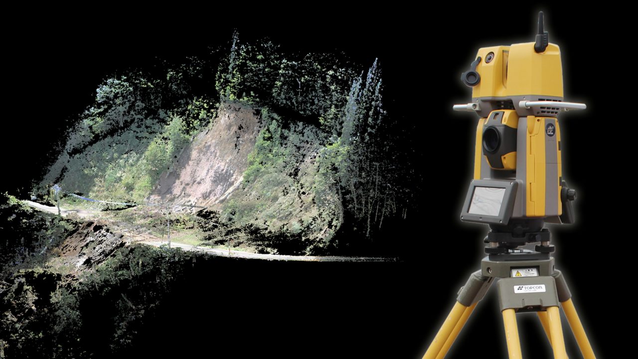
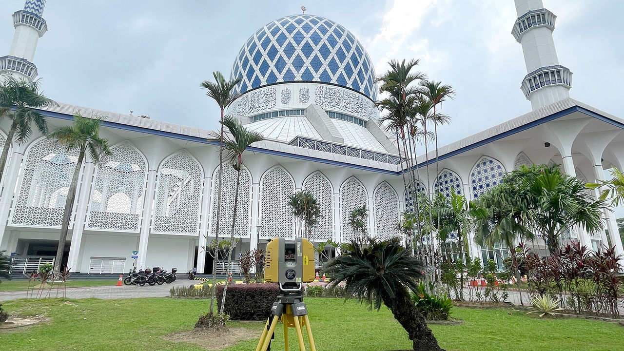
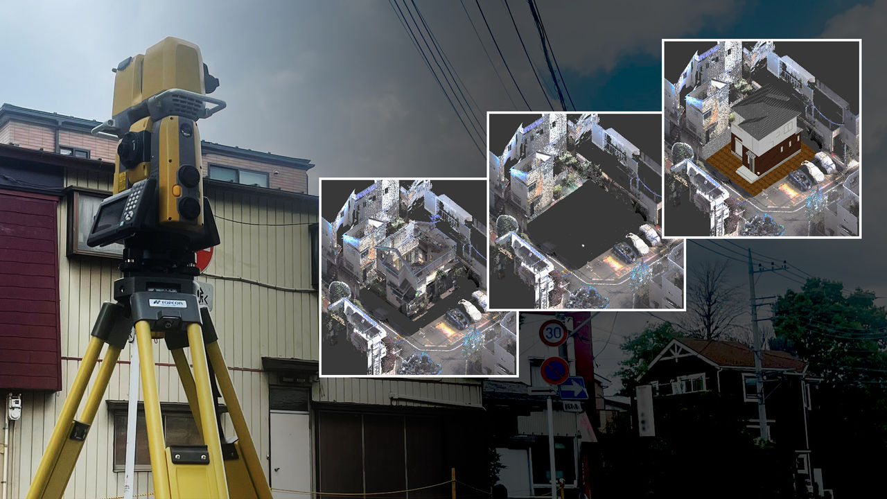
Laser Scanner Total Station Case Study
GTL-1000
Capture 3D Point Cloud Data at Any Site
GTL-1000 with integrated total station and scanner allows you to use 3D point cloud data every day.
Sankyo Consultant Co., Ltd. in Tendo City, Yamagata, is a construction consultant company that offers a broad range of services from land survey, design, and compensation consultancy to environmental and geological surveys. This is the story of why the company decided to use the GTL-1000 Laser Scanner Total Station.
Key Factor in Decision was “Ease to Use”
Sankyo has used unmanned aerial vehicles (UAVs) for photogrammetry since 2017 and accumulated a wealth of experience with using 3D point cloud data for applications, such as creating VR maps for clients, where the design data is superimposed on the maps, or creating the design of vertical profile and cross section for the construction sites.
Before deciding to introduce the GTL-1000, Sankyo’s President & CEO Hiroshi Otaka also considered other alternatives, such as LiDAR-equipped UAV or terrestrial laser scanners. However, he chose the GTL-1000 because the total station and laser scanner are integrated into a single unit, so it can be used frequently and is cost effective. Another key factor was the opinion of a field engineer who said “it looks like it is easy to use because point cloud data can be captured in the same manner as using a total station.”
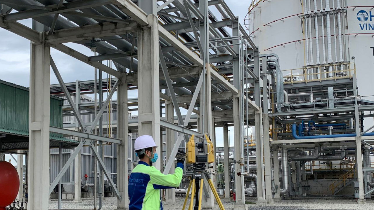
Two Instruments in One Unit: Survey and Point Cloud Measurement in a Single Session
Sankyo’s Survey and Design manager Ryo Kumata talked about the results of using the GLT-1000. “Surveying becomes very efficient. For example, traditionally, we conducted an existing condition survey using the total station, but sometimes we had to conduct an additional survey to add details. Meanwhile, the GTL-1000 allows us to conduct a survey and scan to capture point cloud data in a single session. We can therefore complete a survey at one time.” Now the company uses 3D point cloud data at all times. “Since we can determine the heights and layout of the features, which could not be done before with photographs, today we conduct a scan at every site. It is very convenient because we can use visual maps for presentation and deliver data for confirmation to our clients,” said Kumata.
Along with that, Sankyo’s Survey and Design’s Survey Group member Masato Shibuya gave an example of disaster recovery work that required a current condition survey of a prefectural road site that was impassable due to a landslide. “We completed the whole survey process from reference point setup to scanning in just a day. It was quite effortless because we can use it in the same manner as the total station and conduct a scan in a single session. In addition, everything can be done with a single unit. This reduces the number of equipment items so it is helpful for a field engineer.”
3D Point Cloud Data Opens Up the Future
Finally, President Otaka talked about the future vision. “We can use 3D point cloud data for various applications, such as a geological survey, vegetation and forest management, and geographical information system (GIS). We are confident that we can expand our consulting business by utilizing it.”
Otaka also revealed his aspiration to “contribute to cultivating young talent by conveying the information of using advanced IT technology in the land survey business.” As part of the efforts, Kumata, who also works as an outside lecturer at Yamagata College of Industry and Technology, uses the GTL-1000 as a case study in his class.
Interviewees
COMPANY: Sankyo Consultant Co., Ltd.
URL: https://www.sankyo-y.co.jp/
TOPCON PRODUCT: Laser Scanner Total Station GTL-1000
Related Item
News
Events
- Start Date
- 2025/11/06
- End Date
- 2025/11/09
- Event Name
-
PhilConstruct Manila 2025
- Event Details
-
Date: November 6-9, 2025 (Thursday - Sunday)
Venue: World Trade Center Metro Manila & SMX Convention Center Manila, Philippines
Time: 9:00am - 6:00pm
Organizer: Philippine Constructors Association Inc. (PCA)
- URL
- https://philconstructevents.com/manila/
- Target
- _blank
- Start Date
- 2025/10/28
- End Date
- 2025/10/31
- Event Name
-
BuildXpo 2025
- Event Details
-
Malaysia International Building and Construction Industry Showcase
Date: October 28–31, 2025 (Tuesday – Friday)
Venue: Hall 2 & 3, MITEC (Malaysia International Trade and Exhibition Centre), Kuala Lumpur, Malaysia
Organizer: Ministry Of Works, Malaysia (KKR), Malaysia & Construction Industry Development Board (CIDB)
- URL
- https://buildxpo.com.my/index.php
- Target
- _blank