Building Inspection solutions
Inspect Floors and Entire Spaces All at Once
Checking the flatness of concrete floors and the installed structural members is a tedious and time-consuming task.
With Topcon's 3D scanner and software, both floor and structural flatness verification can be done at the same time.
Productivity with labor-saving and building quality can be improved through area and total inspections.
Contents
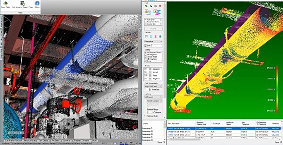
Visualize unevenness - Flatness analysis of concrete floors
The Rithm software provided by ClearEdge3D in the U.S. makes flatness evaluation of concrete slabs super easy.
When the scanned point cloud data is analyzed on Rithm, floor unevenness is visualized using a heatmap.
Compared to the conventional inspection method of checking every few meters using an optical level, this method saves an overwhelming amount of time and improves quality by displaying its results as a surface.
* Rithm will be discontinued at the end of March 2025 and will no longer be supported at the end of March 2026.
 Measurement with levels and handwritten forms → Scanning and software analysis
New inspection method to compare scanned data with designed BIM models
You can ensure that construction is being carried out as planned and that components are installed as designed.
The point cloud* data scanned from the site space and the BIM models used in the design are analyzed and compared using the Verity software developed by our American group company ClearEdge3D.
By preventing human errors such as oversight from construction management and design supervision, reworks that can cause enormous cost increases and construction period delays can be avoided.
 Analysis of presence and deviation of installed materials
 Color-coded results will be shown.
Point cloud represents the cluster of 3D point data measured using 3D laser scanners or other means. The point data contains XYZ coordinates and RGB color values representing the shape, size, distance, position, color and texture of captured objects in the space.
Those types of information are generally brought into CAD or BIM software, and it plays an important role in simulation through the design and construction processes.
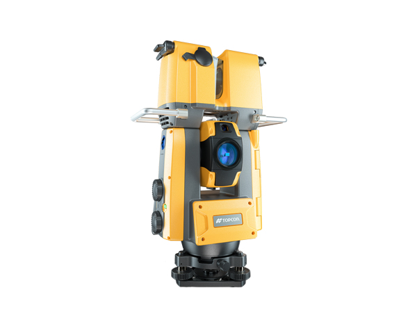
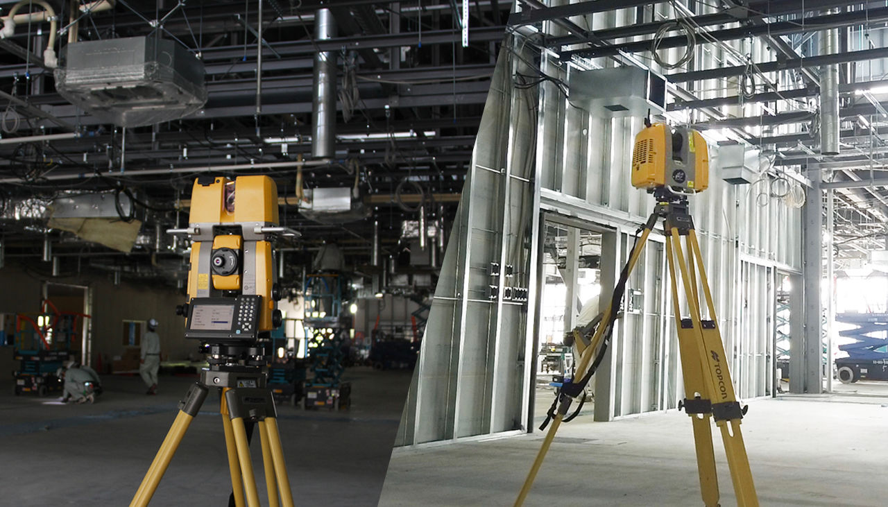
Work with a high-precision scanner for building construction inspection
GLS-2200 is a high-precision scanner ideal for millimeter-accurate construction inspections, such as floor flatness, as-built, and component installation.
Compared to the previous model, the accuracy is now 1 mm (σ) and can generate clear 3D point cloud data with HDR imaging.
The scanner is used not only for inspections, but also for surveying construction land, and for as-built surveying of exteriors and interiors during renovations and remodeling.