- Start Date
- 2024/08/06
- End Date
- 2024/08/09
- Event Details
-
Roadshow
Dates: 6 August 2024, 10:00 to 15:35 in Indonesia Time
Venue: Hotel Borobudur JakartaBootcamp
Dates: 7 to 9 August 2024Organizer: TOPCON POSITIONING ASIA CO., LTD., PT. SYNNEX METRODATA INDONESIA
- URL
- /content/topcon-pa/jp/en/events/2024/topcon-autodesk_roadshow-bootcamp_Indonesia.html
- Target
- _self
Laser Scanner Total Station Case Study
GTL-1000
3D point cloud data is revolutionizing the way we survey land and build homes
GTL-1000 is the best instrument for the land and house surveying business
JFD Advance Survey Co., Ltd. has its head office near Kanda Station in Tokyo. All the employees are licensed land and house investigators and architects, making it a professional group of property surveyors. The company, which covers the entire Tokyo metropolitan area and conducts about 1,500 surveys a year, is using the GTL-1000 laser scanner total station for both as-built survey maps and building simulations. We visited JFD Advance Survey Co to learn more.
A new integrated system for site surveys.
The company, which has good relationships with a lot of housebuilders, mainly works to prepare as-built survey maps for detached house construction and to check whether the construction complies with the Building Standards Act.
In the past, the company’s employees surveyed with a total station, went back to the office, created drawings from the CAD files, and delivered paper-based drawings. The surveying and photography were done by two people, working in pair.
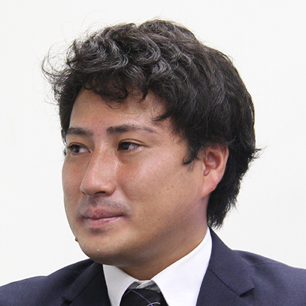
“At first, our goal was to reduce labor costs and work hours,” says Shinsuke Inayoshi, President of the company. Since the department started using the GTL-1000, only one person is needed to do both the surveying and photography..
Also, the company can rely on junior staffs to produce high quality work with GTL-1000 which it was only possible with an experienced expert to do the point measurements. With the scanning total station, even a young and inexperienced person can measure the entire perimeter, which can be easily verified later.
Also, with this system, human error is reduced, and less travel is needed. Previously they often had to go back to re-survey because of some oversight. Now, with the ability to collect 3D point cloud data during the survey process, they rarely need to go back to the site to resurvey. Scanner, they can acquire all the 3D point cloud data, so they don’t need to re-survey anymore.
Also, if they need to add the height of a fence or other dimensions later, they can extract the missing information from the point cloud, as well as use it to compare to the survey data; hence reduce human operating error.
The main reason the company selected the GTL-1000 was that it is an integrated total station and scanner. “We do both traverse surveying and boundary point surveying, and it’s difficult to identify the exact location with 3D point cloud data. That’s why an integrated scanner like the GTL-1000 is the best choice for us,” said President Inayoshi..
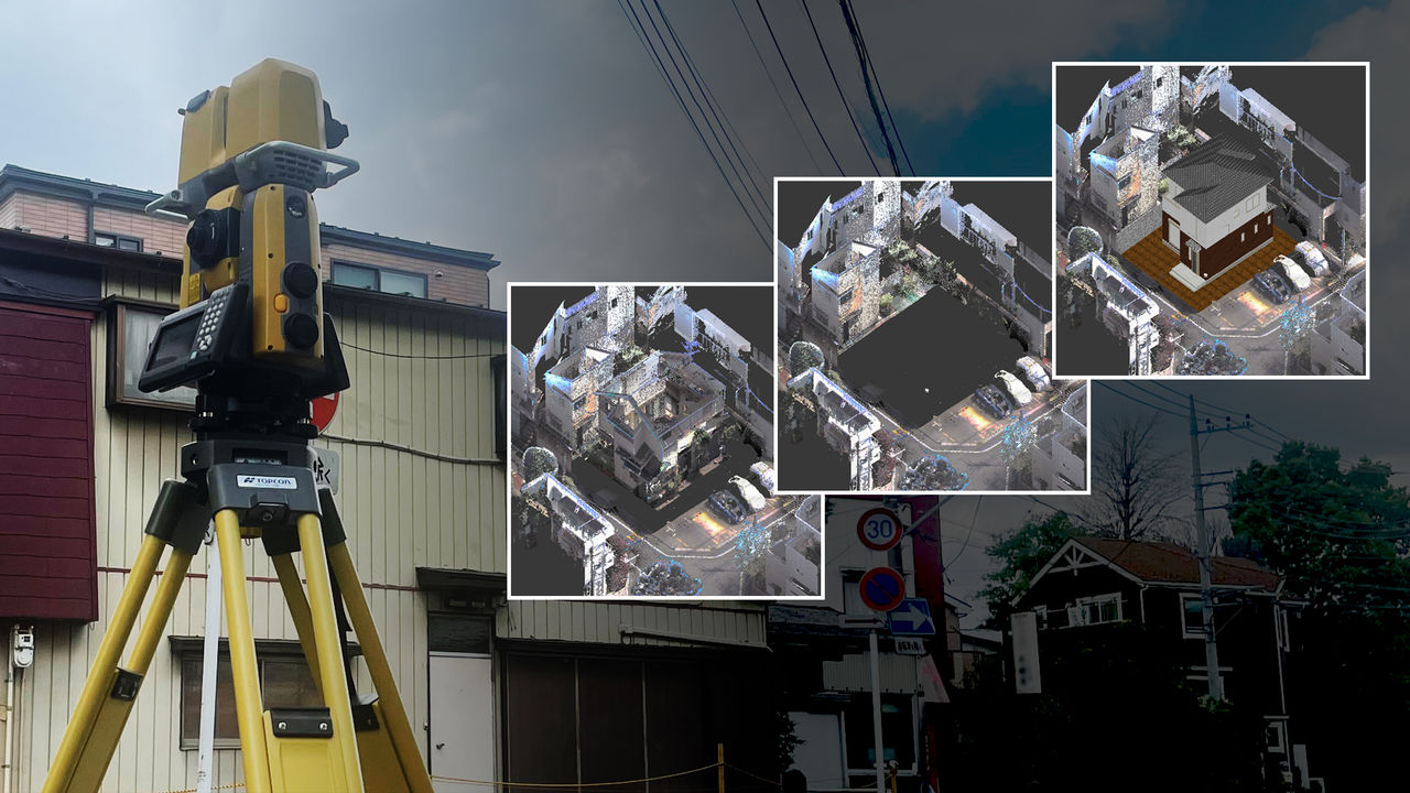
The simulation changes the rebuilding of a house.
Even now, some paper-based drawings are still required, but mostly to deliver the data. The 3D point cloud data is also delivered, and the company does see that the trend is that digital files will be used more and more..
Mr. Shun Takagi from the Survey Section described an interesting way to use 3D point cloud data–.
to simulate a completed house after it has been built.
The entire area around the house is scanned, and the existing houses are erased from the data to make the image clear. The 3D model designed by the housebuilder is then placed on top. This way, it is clear what the house and surrounding landscape will look like after the house has been building. The system also enables people to check the view from inside the house, and even position the windows in relation to the neighboring houses and line of sight from the road. Finally, the company can even offer image confirmation through virtual reality, which housebuilders and clients regard highly.

I want to open up the future of the industry.
“We agreed to be interviewed because we want to introduce this simulation using 3D data,” said President Inayoshi. “It is often said that you have to build a house three times before you get the ideal house.
However, if you do the simulation beforehand, you can ‘see’ and ‘feel’ the house before ordering. I hope this method will spread and revitalize the surveying, land surveying, and construction industries.”
Interviewees
COMPANY: JFD Advance Survey Co., Ltd.
URL: https://as.jfd.jp
TOPCON PRODUCT: Laser Scanner Total Station GTL-1000
Related Item
News
Events
- Start Date
- 2024/07/02
- End Date
- 2024/07/05
- Event Details
-
Roadshow
Dates: 2 July 2024, 10:00 to 16:45 in Malaysia Time
Venue: Sofitel Kuala Lumpur DamansaraBootcamp
Dates: 3 to 5 July 2024Organizer: Topcon Positioning Asia (Malaysia) Sdn. Bhd., 3Dtech Solutions Sdn. Bhd.
- URL
- /content/topcon-pa/jp/en/events/2024/topcon-autodesk_roadshow-bootcamp_malaysia.html
- Target
- _self
- Start Date
- 2022/10/26
- End Date
- 2022/11/29
- Event Details
-
Venue : Webinars
Hosted by : Topcon / Autodesk
- URL
- /content/topcon-pa/jp/en/events/2022/10309.html
- Target
- _self


