


- Start Date
- 2026/02/14
- End Date
- 2026/02/16
- Event Name
-
KRISHI DARSHAN EXPO 2026
- Event Details
-
Visit the Topcon Booth to Discover Cutting-Edge Precision Agriculture Technology!
Dates: 14- 16 February'2026, 10:00 A.M. to 6:00 P.M.
Venue: Northern Region Farm Machinery Training & Testing Institute, Hisar, Haryana, India - URL
- https://www.krishidarshanexpo.com/
- External URL
- Target
- _blank
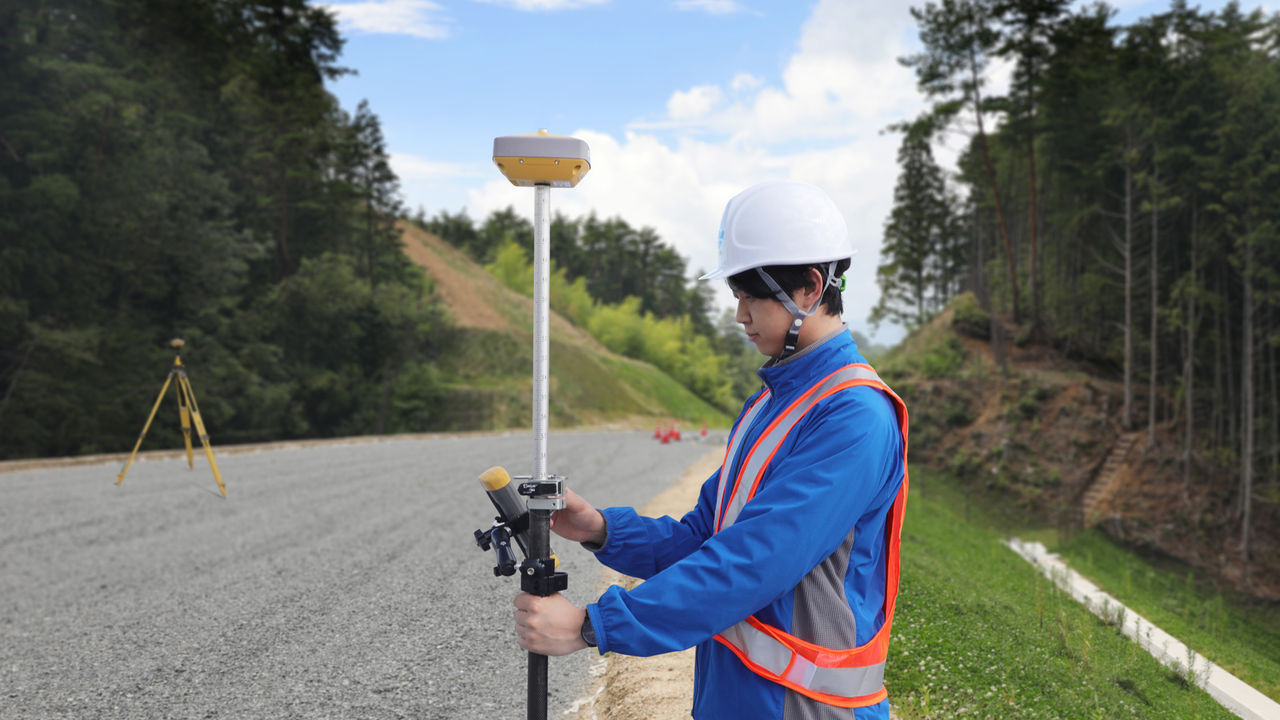
HiPer VR
Versatile GNSS Receiver
Complete, Cutting-Edge Performance
- Universal Tracking Channels™ for all satellites, signals and constellations
- Field-tested, field-ready IP67 design
- Compact form factor ideal for Millimeter GPS and Hybrid Positioning™
- Revolutionary 9-axis IMU and ultra-compact 3-axis eCompass
Better things in smaller packages

The HiPer VR is smaller and lighter, but don’t let its small size fool you. It’s not only packed with the most advanced GNSS technology, it is also built to withstand the harshest field environments. Built with a rugged housing – not weak plastic – it can take the punishment of the job site.
Using the Topcon advanced GNSS chipset with Universal Tracking Channels™ technology, the receiver automatically tracks each and every satellite signal above – now and into the future.
All signals, all satellites, all constellations — all in a compact, rugged design, with an integrated IMU and eCompass.
TILT™- Topcon Integrated Leveling Technology

The HiPer VR incorporates a revolutionary 9-axis inertial measurement unit (IMU) and an ultra-compact 3-axis eCompass. This advanced technology compensates for mis-leveled field measurements out of plumb by as much as 15 degrees.
Awkward shots on steep slopes or hard to reach spots are now a breeze with TILT.

L Band Ready Technology
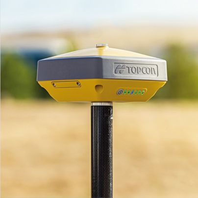
L Band ready to receive advanced GNSS corrections data set globally.
Highly configurable

Designed to grow with you, unique electronic option files empower you to activate available features instantly.
Software
MAGNET® software is tailored for use with Topcon GNSS receivers in both field and office functions.
MAGNET Field

MAGNET Field software increase your productivity and connect you to others in the field as well as in the office.
Features:
Cloud connected data exchange and backup,Topo, X-Section, StakeOut, Real Time Roads, Calculate Areas & Volume, DTM,Generate Contour and more.
MAGNET Enterprise

A managers dream of tracking all field and office data in one simple to access web interface. Store and exchange your field data in the Enterprise cloud. Save the drive time by sending your field and office updates to the cloud rather than driving back to office.
MAGNET Office

Full CAD functionality with MAGNET Office Site and Topo. Or field data processing with MAGNET Office Tools inside AutoCAD® products, like Civil3D®. The MAGNET Office solution module that best fits your needs.
Brochure
Related Item
Related Case Study
Related Information
News
What's New
Events
- Start Date
- 2025/12/09
- End Date
- 2025/12/13
- Event Name
-
EXCON 2025
- Event Details
-
Please visit our booth to Experience the Topcon ICT Solutions in Construction!
Booth No: C-50
Hall No: 05
Dates: 09- 13 December'2025, 10:00 a.m. to 6:00 p.m.
Venue: Bangalore International Exhibition Centre, Karnataka, India - URL
- https://www.excon.in
- External URL
- Target
- _blank
- Start Date
- 2025/12/02
- End Date
- 2025/12/04
- Event Name
-
GeoSmart Expo 2025
- Event Details
-
Visit us at Booth No. B-24
Dates: 02 - 04 December' 2025
Venue: Bharat Mandapam, Delhi, India - URL
- https://geospatialworld.net
- External URL
- Target
- _blank